

Severe Thunderstorm Alert Issued: What You Need to Know to Stay Safe
In recent days, several regions across Europe have been placed under an alerte d’orages violents, or severe thunderstorm alert, as weather conditions continue to grow increasingly unstable. Meteorological services are urging residents to remain vigilant, as intense storms accompanied by strong winds, heavy rainfall, and potential hail are expected to sweep across affected areas.
What Is a Severe Thunderstorm Alert?
A severe thunderstorm alert is issued when meteorologists detect the potential for extreme weather that can pose a threat to life and property. This includes thunderstorms with heavy downpours, wind gusts exceeding 80 km/h (50 mph), frequent lightning, and sometimes large hail. In rare cases, tornadoes may also develop under these unstable conditions.
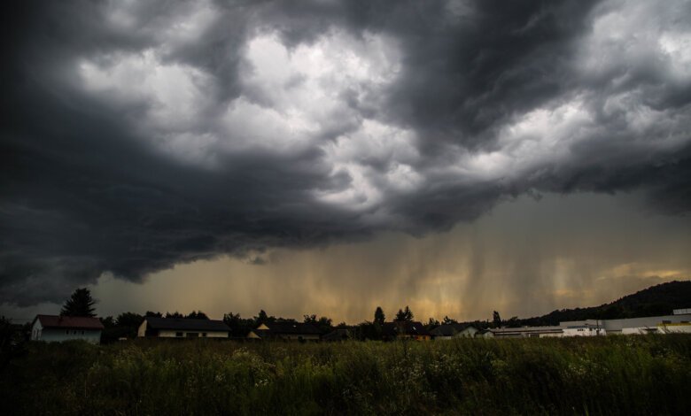
Regions Under Alert
As of this week, large portions of France, Belgium, Germany, and northern Italy have been placed under orange and red alerts — indicating moderate to high risk. These alerts typically cover both urban and rural areas, and local governments are taking precautionary steps to ensure public safety. Commuters and travelers are advised to monitor local weather updates and avoid unnecessary travel during peak storm hours.
Expected Weather Conditions
According to Météo-France and other European meteorological agencies, the storms are likely to bring:
- Heavy rainfall: Up to 50mm in just a few hours, increasing the risk of flash flooding.
- Strong wind gusts: Potential to damage trees, power lines, and rooftops.
- Hailstorms: Hailstones up to 3cm in diameter, which can damage vehicles and crops.
- Frequent lightning: Posing a fire hazard and potential for electrical surges.
These thunderstorms are part of a larger weather system fueled by a clash of warm, humid air from the south and cooler air masses from the north. This atmospheric instability is expected to persist for the next 48 to 72 hours.
Safety Tips for Residents
Authorities strongly urge everyone in affected areas to take safety precautions:
- Stay indoors: Avoid going outside unless absolutely necessary during a storm.
- Secure outdoor objects: Bring in or tie down garden furniture, trash bins, and bicycles.
- Unplug electrical devices: Prevent damage from power surges due to lightning.
- Avoid flood-prone areas: Do not attempt to cross flooded roads on foot or in vehicles.
- Stay informed: Monitor weather updates via local news, apps, or official meteorological websites.
Travel Disruptions and Closures
Transportation networks may also be impacted. Flight delays, train cancellations, and road closures are likely in high-risk zones. Travelers are encouraged to check with airlines, rail operators, and local authorities before departing. Additionally, some public events have been postponed or canceled as a precaution.
Impact on Agriculture and Infrastructure
Farmers are particularly concerned about crop damage due to hail and excessive rainfall. Local agricultural associations have warned of potential economic losses, especially for vineyards and summer crops.
Urban areas may experience power outages, fallen trees, and traffic congestion, particularly during the morning and evening rush hours. Emergency services are on high alert and ready to respond to incidents related to storm damage.
Final Thoughts
The alerte d’orages violents serves as a critical reminder of nature’s unpredictability. With the proper precautions, the risks can be minimized. Everyone in the affected zones should act responsibly and stay prepared until the alert is lifted.
For continuous updates and safety recommendations, follow your country’s official meteorological agency and local authorities.